Baltic GPS War: How Jamming Forces a NATO PNT Rethink
A September surge in GPS jamming and spoofing across the Baltic and NATO’s Eastern Sentry response are forcing a fast reset in how allied forces navigate, time, and fight in contested skies and seas.

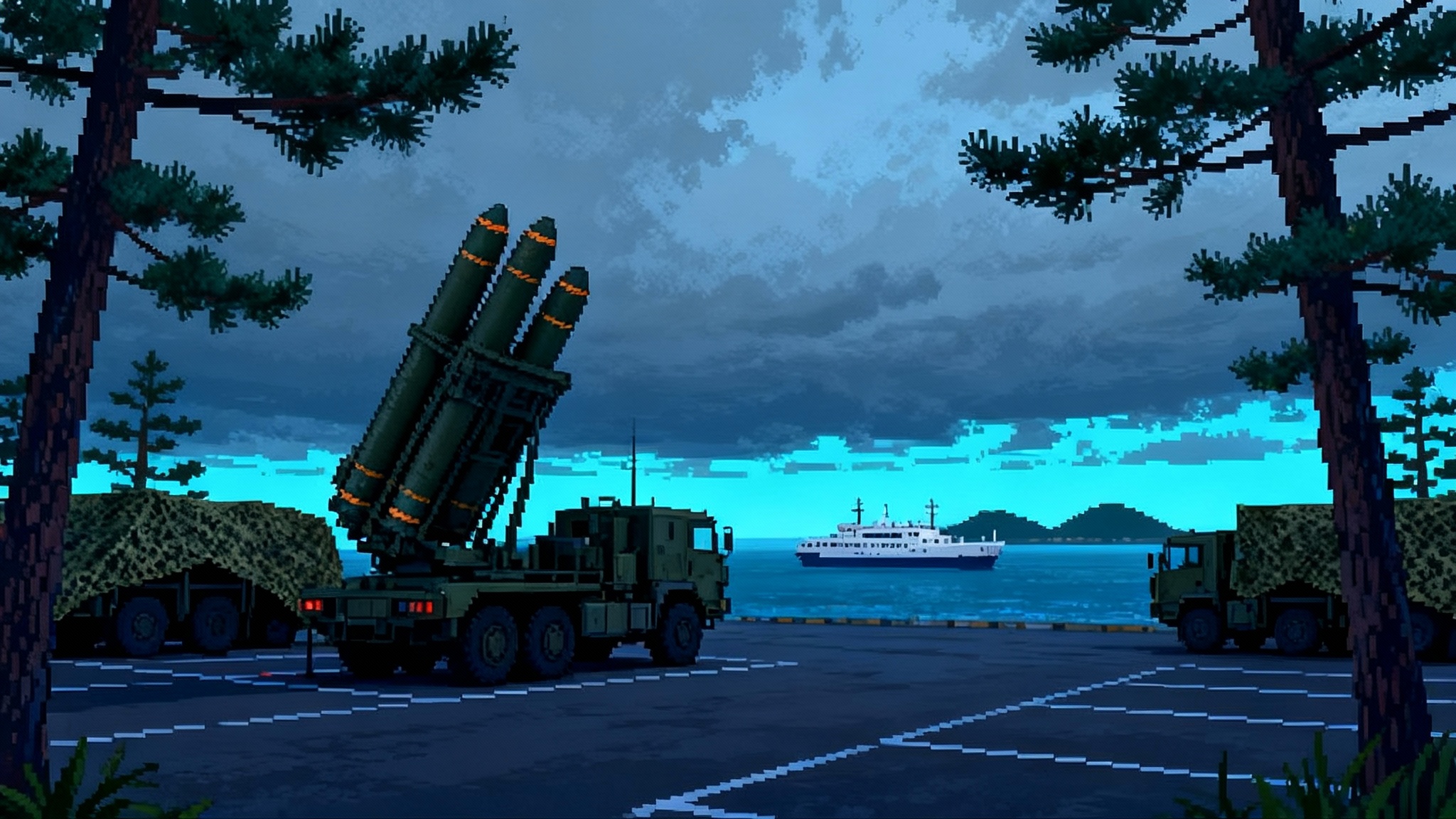
September 2025: the Baltic skies go noisy
The Baltic region spent September learning to fly and sail without a safety net. Commercial crews reported false tracks and dropouts, air traffic controllers issued cautionary bulletins, and military patrols switched quietly to backup procedures. The month’s defining image was not a dogfight but a cockpit message flashing NAV UNRELIABLE while radios hummed with terse calls.
The signals war was not abstract. On September 24, Spain’s defense minister flew to Lithuania and her military aircraft experienced GPS interference near the Kaliningrad exclusion zone, an event Madrid called routine for the region and managed without incident thanks to encrypted navigation and other backups. The episode was a public reminder that jamming and spoofing around the Baltic Sea are now persistent and deliberate, and that they can touch VIP flights as easily as line missions. Reuters reported the incident and placed it squarely in the growing pattern of interference in the area, including earlier cases affecting senior EU officials. Spanish jet GPS disruption near Kaliningrad.
Two weeks earlier, a wave of Russian drones crossed into Poland, triggering a Quick Reaction Alert and a blizzard of national and NATO consultations. The alliance’s response was Eastern Sentry, a named operation that concentrates air and ground assets along the eastern flank to catch drones and to harden command networks that depend on precise positioning and time. Poland’s government confirmed the operation on September 12 and framed it as a direct response to drone incursions. Poland confirms Eastern Sentry.
Taken together, these events forced a blunt conclusion. The Baltics are in a sustained GPS war, and the collateral damage is the old assumption that precision navigation and timing are always there. Militaries are adjusting at speed, moving from bolt-on fixes to a layered position, navigation, and timing architecture that remains coherent when satellites flicker.
Why the Baltics are a PNT battleground
The geography is unforgiving. A narrow sea, crowded air routes, dense port approaches, and a chessboard of critical infrastructure create short distances and fast timelines. Russian forces in Kaliningrad and western Russia have the power, the proximity, and the incentive to shape the electromagnetic environment around the clock. Even modest-power jammers can deny civilian GPS across large segments of airspace if sited well. Sophisticated arrays and beam-steered systems can carve out bubbles over specific corridors or sea lanes. Spoofers that rebroadcast altered navigation signals can push an aircraft off course silently if the crew relies blindly on a single constellation.
The political tempo adds pressure. After the September drone incursions, allied air policing and maritime patrols surged. Old playbooks that assumed fair-weather GPS gave way to operational plans designed for contested PNT as the default. The question in every briefing is becoming not whether there will be interference, but how the force will fight through it.
What jammers and spoofers are doing
- Uplink jamming saturates the receiver front end with noise or structured interference, leading to abrupt loss of lock or degraded accuracy. Even short bursts force a navigation mode switch.
- Meaconing and spoofing replay or synthesize GNSS signals so that a receiver tracks malicious satellites with believable timing, then drifts toward a false solution. Deception that shifts position slowly is harder to detect than a hard jump.
- Denial through geometry targets choke points, like approaches to airports, ferry lanes, and TMA fixes, to maximize operational disruption.
- Cross-domain effects couple PNT loss to communications. Datalinks with strict timing windows degrade, and distributed air defense networks see cueing errors spread quickly.
The result is a fog of PNT: crews receive alarms, autopilots disengage or revert, timing-dependent radios desynchronize, and command centers see tracks that wobble, lag, or vanish.
The hardening playbook: layered, not linear
Militaries across NATO are converging on a simple principle. No single sensor is trusted; navigation and timing are synthesized from many. The architecture is layered in four broad tiers: anti-jam and anti-spoof at the antenna and receiver; multi-constellation and multi-frequency resilience; deep holdover using inertial and terrain cues; and alternate PNT sources that do not rely on medium Earth orbit GNSS. The art is in tuning the fusion so crews get a stable picture without hiding the uncertainty.
Resilient receivers and CRPA antennas
- Controlled Radiation Pattern Antennas block interference by physically shaping the sky. Arrays form nulls in the direction of a jammer and place gain lobes on authentic satellites. Modern CRPA systems do this with fast digital beamforming, allowing simultaneous nulling of multiple threats while preserving high elevation gain. The payoff is measured in tens of dB of extra jammer margin and in the harder-to-quantify confidence that the antenna is not a passive straw.
- Multi-constellation, multi-frequency receivers track GPS, Galileo, and often GLONASS and BeiDou where policy allows, and they use both legacy and modern signals. Military platforms combine encrypted GPS M-code and Galileo Public Regulated Service where permitted. Dual-frequency processing removes much of the ionospheric bias and allows cross-checks between independent satellite clocks and geometries. Spoofing that fools one constellation but not the others becomes easier to detect.
- Signal authentication is moving from crude checks to cryptographic and power-time consistency measures. Receivers compare angle of arrival across the CRPA, evaluate the carrier-to-noise rise under suspect conditions, and watch for satellite IDs that do not match almanac expectations. Many now carry a spoofing probability metric that informs the flight management system and, crucially, the crew.
Inertial and terrain aided navigation
- Inertial navigation is the skeleton key for PNT holdover. Ring laser and fiber optic gyros on fast jets provide superb short-term attitude and rate data, while maritime and ISR platforms are adding cold-atom or high-grade MEMS units for better drift performance. The trend is to feed the inertial with a trickle of trusted updates from everything available so that drift, rather than exploding, stays bounded.
- Terrain-aided navigation blends radar altimeter profiles or synthetic aperture radar returns with stored digital terrain models to lock position even when satellites are denied. Over the Baltics, where coastlines, islands, and port approaches create rich features, terrain matching can deliver sub-100 meter fixes when tuned well. For low-level aircraft and cruise missiles this has always mattered; now high flyers and helicopters are using it more often.
- Vision-based navigation uses electro-optical or infrared cameras to match landmarks and coastlines to onboard maps. It is not a magic bullet in fog or heavy snow, but in fair conditions it gives another independent fix and, importantly, an intuitive picture the crew can sanity check.
Timing resilience and clocks
- Precise time is as critical as position. Air defense networks and tactical datalinks rely on microsecond-level alignment to coordinate radar plots, deconflict emissions, and schedule transmissions. When GNSS-derived time drops, platforms fall back on disciplined oscillators and chip-scale atomic clocks that can hold microsecond accuracy for hours to days.
- Time transfer is diversifying. Fiber-delivered time from national metrology institutes to air defense nodes, low frequency terrestrial broadcasts, and time-over-radio techniques are all in play. The goal is to avoid a single point of failure and to prevent cascading desynchronization.
Alternative PNT: eLoran, LEO PNT, and maritime R-Mode
- eLoran is having a second act. Its 100 kHz transmissions are hard to jam over large areas, penetrate urban canyons, and provide both coarse position and robust timing. Several Baltic littorals are evaluating regional chains aligned with maritime traffic and energy infrastructure. The receivers are light and cheap, which appeals to coast guards and harbor pilots.
- LEO PNT from dedicated providers or opportunistic signals of opportunity offers geometry and power advantages. Satellites in low orbit present higher received power and faster-changing angles. Even without cryptographic authentication, LEO-based ranging combined with inertial and terrain cues can keep platforms on task through extended GNSS outages. This echoes the LEO networking push seen in SDA Tranche 1 transport layer.
- R-Mode leverages existing maritime beacons and AIS base stations to deliver meter-level positioning around ports and coastal routes. It is not a blue-water solution, but for the Baltic’s constrained lanes it is a pragmatic hedge against spoofed GPS at the pier head.
What it means for air defense on the eastern flank
Integrated air and missile defense nodes treat PNT like oxygen. Sensors need time alignment to form coherent tracks, shooters need precise geometry to compute intercepts, and the command layer needs assured datalinks to manage engagement zones without blue-on-blue risk. GPS loss ripples through that stack.
- Radar cueing and composite tracks can drift when time bases diverge. The counter is networked timing discipline with holdover clocks at each node, plus automatic time sanity checks between peers.
- Engagement planning relies on accurate ownship position. Batteries and aircraft now run continuous integrity monitoring, cross-checking inertial, GNSS, and any available terrestrial fixes. When uncertainty grows, doctrine calls for tightening rules of engagement and reducing shot doctrine aggression until the picture is clean.
- Link 16 and newer waveforms tolerate some timing error, but persistent GNSS denial forces networks to use time slot reallocation, lower duty cycles, and fallback synchronization from airborne relays. Airborne gateways with stable clocks become flying time masters.
- Counter-drone operations change tempo. Shooters shift to electro-optical tracking and passive RF targeting when GNSS-based cues get noisy. Mobile air defense units keep moving on preplanned routes that can be navigated with dead reckoning and terrain cues to avoid being frozen by spoofed coordinates.
These habits mirror the discipline of the Guam joint kill web, where timing, cross-domain cueing, and resilient routing are baked into daily operations.
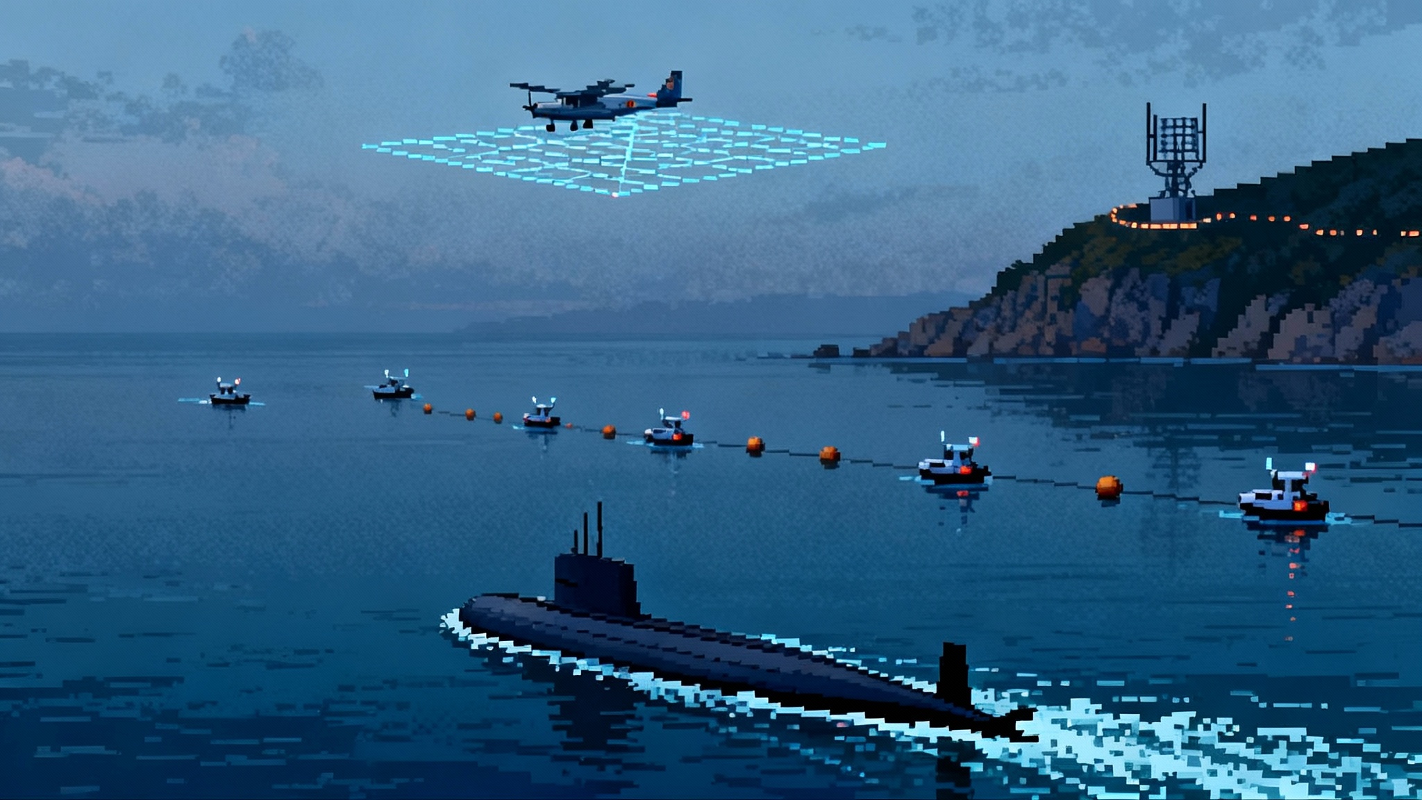
The maritime fight: ports, pipelines, and patrol patterns
The Baltic Sea compresses risk into lanes and chokepoints. Spoofed GPS near port approaches can shove a ship’s displayed position tens or hundreds of meters off the fairway. That is enough to miss a buoy, brush a pier, or hide a hostile vessel inside the clutter of false AIS echoes.
- Warships lean into radar navigation, visual piloting, and inertial fixes more often. Bridge teams practice loss-of-GNSS routines so that handoffs between combat system, navigation suite, and human pilot are smooth, not panicked.
- Maritime patrol aircraft plan legs and turns by timing and distance again, with GNSS as a contributor rather than the master. When GNSS drops, crews ride inertial and terrain cues, and they still find submarines and suspicious trawlers because the sensors, not the coordinates, are the mission.
- Critical undersea infrastructure forces a different calculus. Patrol patterns are flown to keep sonars and towed arrays over specific grids. Timing errors can smear acoustic tracks and reduce revisit rates. The fix is disciplined timing at the mission system level and cross-cueing between platforms so that one unit’s clock drift does not degrade the whole picture.
Interoperability and alliance politics in a PNT crisis
Eastern Sentry makes a virtue of diversity. Different nations bring different equipment, different crypto, and different PNT pedigrees. In a benign environment that can be friction. In a contested one it becomes a hedge, provided the alliance agrees on a few foundations.
- Common integrity language. A Dutch F-35 and a Polish Patriot battery should express PNT confidence in comparable terms so a German controller can make engagement decisions without guessing. Cross-nation standardization of integrity flags and alarm thresholds is now as important as shared coordinates.
- Shared time. The alliance is moving toward multiple, redundant time sources. Some will come from national labs over fiber, some from satellites, some from eLoran or LEO. The policy question is who is allowed to be a time master and how often networks switch masters when confidence dips.
- PRS and M-code coexistence. Several allies field receivers that can use encrypted Galileo PRS as well as GPS M-code under national control. The political and technical challenge is key management and rules of use when multinational packages fly together. Eastern Sentry is a forcing function to sort that out in standing procedures rather than on the fly.
- Civil-military coupling. Air traffic control, pilots’ unions, port authorities, and coast guards are now part of NATO’s PNT resilience loop. When civil sectors flag anomalies, the uniformed side can adapt routes and alert crews faster. When military units detect spoofing, civil agencies need the report in minutes, not days.
Field notes from the hardening front
- Fighters and tankers now brief specific loss-of-GPS contingencies for the first leg and the last leg of every mission. That is where commercial jammers near roads and hostile emitters near borders have the most effect.
- Helicopters add terrain-aided nav packages that were once reserved for missiles and special operations aircraft. Crews are rediscovering the value of accurate radar altimeter profiles married to good maps.
- Uncrewed aircraft scatter more INS and alt-PNT capability across the fleet. Losing GNSS no longer means an immediate abort; it becomes a known, recoverable mode with shorter legs and more conservative profiles. This aligns with emerging collaborative combat aircraft concepts that assume degraded PNT as a baseline.
- Warships train bridge and CIC teams to challenge each other’s navigation solutions. If radar ranges, visual bearings, and INS disagree with the electronic chart, the deck officer calls the turn based on what holds up, not what is most convenient.
What to watch next
- eLoran decisions. Expect concrete commitments about transmitters on the Baltic rim, with timing services first and full positioning to follow.
- LEO PNT maturation. Trials will expand aboard patrol aircraft and small warships, mostly as a timing supplement and a cross-check against spoofing.
- Authentication at scale. Receivers that can verify navigation data in the field without draining crypto keys will become standard. Air forces will measure success by fewer nuisance alarms and more confident autopilot use even under hostile conditions.
- Interoperability drills. Eastern Sentry will drive cross-border exercises where mixed national packages practice timing failover, spoof detection, and GNSS-denied intercepts as scripted events, not surprises.
The bottom line
The Baltics have shown that PNT is a battlefield, not a background service. September’s jamming, spoofing, and drone provocations did not ground fleets or freeze ports, but they forced a rethink that is now policy. With Eastern Sentry in effect, NATO is hardening the essentials: antennas that ignore liars, receivers that cross-examine, inertials that carry the load, and alternate beacons that do not care what medium Earth orbit is doing. In air defense, in maritime patrol, and across alliance networks, the new rule is simple. Never trust a single source, always know your uncertainty, and keep fighting while the sky lies to you.