LEO Navigation Goes Live, And GPS Finally Gets a Backup
With Xona’s Pulsar‑0 on orbit and U.S. regulators pushing diversification, low Earth orbit PNT is shifting from demos to deployment. Here is how it changes resilience, costs, and timelines.

What just happened
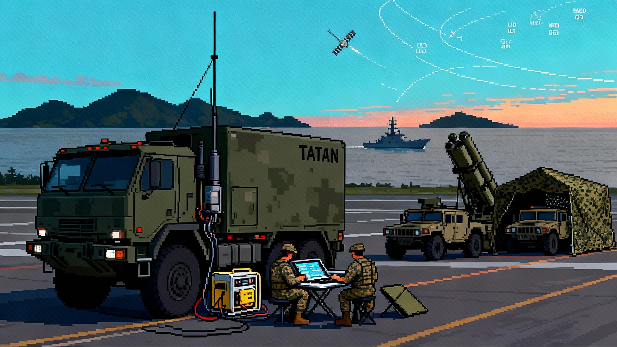
For years, low Earth orbit navigation sat in the demo stage, a neat lab capability in search of a real, resilient network. That changed in 2025. On June 20, 2025, Xona Space placed Pulsar‑0, its first production‑class satellite, into orbit, kicking off live‑sky testing with early users and moving a commercial low Earth orbit positioning, navigation, and timing service from concept to deployment. The company’s own announcement framed it as the start of a service with stronger signals and authentication features designed to survive the kind of interference that has become routine near conflict zones and tense borders. Xona’s Pulsar‑0 launch announcement sets an unmistakable marker: low Earth orbit PNT is no longer a white paper.
Two other developments make 2025 the inflection point. First, the Air Force Research Laboratory awarded fresh funding to test the low Earth orbit service on commercial user equipment, with partners evaluating jamming resistance and security features in contested environments. Second, on March 27, 2025, the Federal Communications Commission opened a formal proceeding to promote alternatives and complements to the Global Positioning System. That proceeding has already drawn highly detailed, government‑level input about what a resilient, multi‑layered PNT architecture should look like. See the National Telecommunications and Information Administration’s filing in the FCC docket for a sense of the scope the government is pushing toward. NTIA comments on the FCC’s PNT inquiry show that Washington is no longer just worried about jamming; it is building a plan to diversify.
Why low Earth orbit changes the math
Most of today’s GPS satellites sit in medium Earth orbit, roughly 20,000 kilometers up. Their signals are precise but faint by the time they reach the ground, which is why cheap jammers and spoofers cause outsized headaches. Low Earth orbit satellites fly about one order of magnitude closer. That proximity changes three things that end users feel.
- Power at the receiver goes up. Think of it like moving from a whisper to a normal speaking voice across a room. A stronger signal does not make a receiver invincible, but it raises the bar for an attacker and helps inside buildings, under tree cover, and in dense cities where GPS vanishes.
- Geometry gets dynamic. Low Earth orbit satellites sweep the sky quickly, which produces richer Doppler and angle‑of‑arrival patterns. Receivers can use those dynamics to check whether a signal’s motion makes physical sense and to converge on a fix faster. It is like watching multiple landmarks move across your windshield as you drive, rather than relying on a single distant radio tower.
- Authentication becomes practical. Legacy open GPS signals are easy to imitate. A commercial service can add cryptographic features and techniques such as ranging authentication and signal watermarking. That does not eliminate spoofing risk, but it gives receivers more ways to tell real from fake.
The immediate result is not that GPS becomes obsolete. The result is that GPS can finally share the load. In practice, the best receivers will blend multiple constellations, include inertial sensors, and apply algorithms that down‑weight suspect data. Low Earth orbit simply gives that software a much stronger second opinion.
What is driving the urgency
The last three years have been a live‑fire lesson in how fragile satellite navigation can be. Airlines, cargo ships, drones, and even smartphone users have experienced jamming and spoofing across Eastern Europe, the Middle East, and the Baltic and Nordic regions. Governments have publicly described incidents affecting commercial flights and high‑level delegations. NATO’s aviation planners have warned that interference is more frequent, more sophisticated, and spread across multiple regions, and they have called for upgraded reporting, mitigation, and civil‑military coordination. Regulators and safety agencies have issued bulletins that urge pilots and operators to plan as if navigation outages will occur, not as rare edge cases but as expected events during certain routes and seasons.
This rising interference has three knock‑on effects that matter in planning:
- Air corridors change. When satellite navigation is unreliable, airlines need backup procedures and sometimes different routings, which raises costs and complicates schedules.
- Drones scale cautiously. Civil operators face uncertain risk assessments, and military units rely more on inertial, visual navigation, and preplanned waypoints. That shifts payload budgets and training time. See how rotorcraft are adopting attritable scouts in our take on launched effects on helicopters.
- Logistics slow down. When a port, pipeline, or depot cannot rely on timing signals and precise location, systems fall back to older techniques that are safe but slower. Across a theater, those minutes accumulate.
Low Earth orbit PNT does not eliminate these problems. It gives operators a way to keep moving when legacy signals are muddy.
The new stack: from one signal to a system of systems
The most important strategic shift in 2025 is mental. Navigation used to mean satellites broadcasting one set of signals and receivers listening. Now it is a stack of sources and checks.
- Space layer. Medium Earth orbit systems like GPS and Galileo remain foundational. Low Earth orbit services add power, geometry, and authentication. Some firms offer satellite time transfer without full positioning, valuable for data centers and networks that need nanosecond accuracy.
- Terrestrial layer. Urban beacons and cellular timing provide coverage in canyons and indoors. These are not replacements so much as scaffolding to speed reacquisition and ride through outages.
- Onboard layer. Inertial measurement units, barometric altimeters, visual odometry, magnetic maps, and radar odometry are now core, not accessories. The software fuses them and decides what to trust. In the C2 realm, programs like AI target fusion with TITAN show how resilient sensing and PNT feed faster decisions.
The policy layer is catching up. The FCC’s inquiry invites options that look like the internet did in the 1990s: a future where no single failure takes down the whole. The military vocabulary for this is “assured PNT.” The commercial vocabulary is “service level,” often spelled out in contracts with penalties. Both push vendors to make promises they can measure, for example, how long a receiver can hold a lane or maintain a timing offset when one source gets sketchy.
Who is moving and why
- Xona Space is building a dedicated low Earth orbit service on small satellites, starting with Pulsar‑0 and follow‑on launches. Its pitches emphasize stronger signals, precision approaching a few centimeters with corrections, and authentication to resist spoofing. The Air Force Research Laboratory is paying to test how that works on off‑the‑shelf gear, from small drones to larger platforms.
- Satelles delivers timing and location using signals from an existing low Earth orbit constellation. The company has focused on time transfer for critical infrastructure, such as data centers and network operators that want a backup to GPS‑disciplined clocks. This is a niche with big stakes because timing errors propagate across finance, telecom, and power grids.
- NextNav is building terrestrial beacons and vertical positioning capabilities. While not a satellite system, it fits the new stack because urban coverage and altitude are where classical satellite navigation struggles most.
- Defense primes and integrators are adapting quickly. The business opportunity is in receivers and mission systems that can ingest multiple space and terrestrial sources, decide what to trust in real time, and keep operating without operator heroics.
In short, the center of gravity is shifting from “who has the best satellite” to “who delivers the most reliable solution at the receiver.”
How this reshapes drones, precision fires, and contested logistics by 2027
If 2025 is when the pivot began, the next 24 months are about fielding.
- Small drones. Expect procurement language that requires multi‑source navigation with demonstrable jamming resistance. In practice, that means receivers that fuse GPS, low Earth orbit signals, and inertial sensors, with baked‑in fallback behaviors. Flight controllers will ship with profiles for urban canyons, forested terrain, and near‑border operations, each with different thresholds for how quickly to distrust a degraded signal. This dovetails with autonomy trends highlighted in robot wingmen and autonomy.
- Precision fires. The first deployments will not bet everything on a brand new signal. Instead, fire control systems will use low Earth orbit signals for error checking and rapid reacquisition when GPS degrades, similar to how map apps cross‑check cell and Wi‑Fi. The payoff is less circular error probable drift during the window when jamming pulses on and off, and less time spent waiting for a confident fix before a shot.
- Contested logistics. The least flashy but most consequential wins happen in convoys, depots, and ports. With stronger signals that penetrate roofs and walls, warehouses can track pallets with fewer blind spots. Convoys can keep dead reckoning gaps smaller between jamming bursts. Timing backups keep radio networks synchronized, which means fewer dropped links as units move.
These are not headline dreams; they are integration tasks. They succeed when receivers, antennas, and software ship as kits that maintain performance without operator babysitting.
Costs, constraints, and what could go wrong
No technology wave arrives without tradeoffs.
- Constellation maturity. A single low Earth orbit satellite is enough to prove signal power and authentication, but worldwide, always‑on coverage requires dozens. Providers will roll out regional or duty‑cycled service first. Program managers should write contracts that step up service levels as satellites launch, not pay up front for coverage that does not exist yet.
- Receiver upgrades. Many platforms will need new antennas, low‑noise amplifiers, and software. The hidden cost is certification and airworthiness for aviation and regulated markets. Budget for test ranges and data from real jamming environments, not just lab benches.
- Spectrum coordination. New signals must live peacefully with legacy services. That is why the FCC has opened an inquiry into alternatives and complements instead of anointing a single winner. Expect debates about which bands are best, how to authenticate, and how to keep consumer costs down.
- Adversary adaptation. Stronger signals and authentication raise the bar, they do not remove it. Attackers will learn and adapt. The winning designs assume an arms race and update in software as attacks evolve.
What to do now if you buy or build systems that rely on PNT
- Write for outcomes, not brand names. Specify holdover times, reacquisition speed, and minimum performance during defined jamming scenarios. Require proof in flight or field test data, not only simulation plots.
- Choose receivers that can grow. Favor modules with software‑defined radios and firmware pathways to add new signals. Your 2026 hardware should handle more sources than it did in 2024.
- Budget for antennas and integration. Many failures come from mismatched antennas and poor cable runs. Treat the radio frequency chain as a first‑class design item.
- Test in dirty air. Use ranges or mobile jammers under proper authorization to replicate the interference your operators actually see. Tune algorithms where the real world breaks them.
- Do not forget time. Location gets the headlines, but timing keeps networks alive. Ensure you have at least two independent timing sources and a clear failover plan at every critical node.
How policy accelerates or slows the shift
The FCC’s inquiry matters because it can unlock testbeds, innovation zones, and clear guidance for what is legal and safe for commercial operators. The National Telecommunications and Information Administration’s filings signal that the Executive Branch is aligned on a diversified approach. That alignment reduces the risk that a promising technology gets stuck in regulatory limbo. Defense and civil agencies are already moving money; the key next step is standards that let receivers interoperate without bespoke integration each time.
Allies are moving too. European safety bodies have published plans to mitigate interference and are coordinating with airlines and air navigation service providers. NATO’s committees are pressing for faster reporting and shared mitigation tactics. The effect is a tide that lifts demand for resilient receivers on both sides of the Atlantic, which helps vendors reach scale.
The bottom line
In 2025, low Earth orbit PNT crossed a threshold from experiments to early deployment. A real satellite is on orbit. Real money is in contracts to test it on real gear. Regulators are not just warning about jamming, they are sketching a diversified architecture so that no single signal failure becomes a national problem. The outcome will not be a single new system that replaces GPS. It will be a stack, layered in space and on the ground, that keeps working when any one part falters.
For the next two years, the difference between systems that keep operating and those that do not will come down to design discipline and procurement detail. Stronger signals help. Authentication helps. What truly moves the needle is a receiver and software stack that can decide, in real time, what to trust. If you build or buy systems that depend on position or time, 2025 is your cue to move from wish lists to fielded redundancy. Two years from now, that resilience will feel normal, and the question will not be whether you added a low Earth orbit layer. It will be whether you did it in time to keep your operations on track when the sky turned noisy.